
The hand warmers, a few layers of fleece, and my sleeping bag kept me nice and toasty warm all night, but it was COLD and windy in the morning when we first started hiking. I'm wearing a couple layers of fleece, my down jacket, and my windbreaker.


There were still lots of springs and waterfalls along the way. We had approx. 25 water crossings along the way.
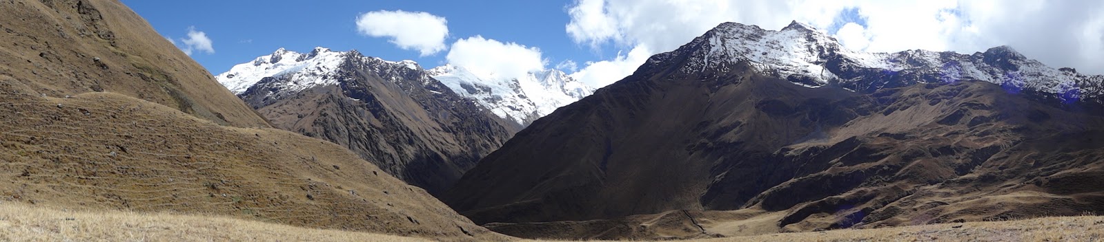
After steadily climbing for about 3.5 hours, we finally reached a grassy meadow where we stopped for a rest (nap) and a snack. The snow capped peaks of Pumasillo were to our north.

and the peaks of Padreyoc were to the south. We will be heading over the pass about 2/3 from the left in the picture (under the biggest blue section of sky).

Because of the altitude and the possibility of somebody getting ill, Vilmar and the emergency horse walked with us instead of the rest of the crew. I think the rest of the crew would be jealous of they saw him resting with us!

After the break, we tackled the final climb to the pass.

Here we are getting closer.

Arturo instructed us to wait at the rocky section just below the pass until the rest of the group arrived. It was really cold and windy but the rocks provided a bit of a wind break. When Emilie and I got there, we saw this family and their mules taking a break before heading down (they were going the opposite direction as us).

We are almost all together.

Brad finally caught up.


Even as we started our descent, we still couldn't see the valley below us.


Finally we got our first clear view of the valley below. Now we just have to get there to set up camp.


Then we started hiking again. The bottom of the valley is getting closer. The light line on the right side of the picture is the trail we were on.


I arrived at camp about 10 minutes after the group, and just before dusk.At this point, we shared a campsite with lots of other groups - all the groups doing the Salkantay trek. The campsite was a lot noisier, with other groups, villagers (a baby crying all night), and livestock. Between the tent on a slope and a pig grunting outside my tent all night, I didn't sleep well. I woke up to the sounds of what sounded like a pig and rooster fighting to the death. Not a good sound!
Trail Stats:
Distance: 21 km / 13 miles
Duration: 9 hours
Elevation gain: 700 m / 2296'
Elevation loss: 1900 m / 6232 '
Camping elevation: 2682 m / 8800'
No comments:
Post a Comment